Urban mobility and mapping
İstanbulaşım
A clearer way to explore Istanbul's transport network.
Live, in active developmentVisit the product site (Opens in a new tab)
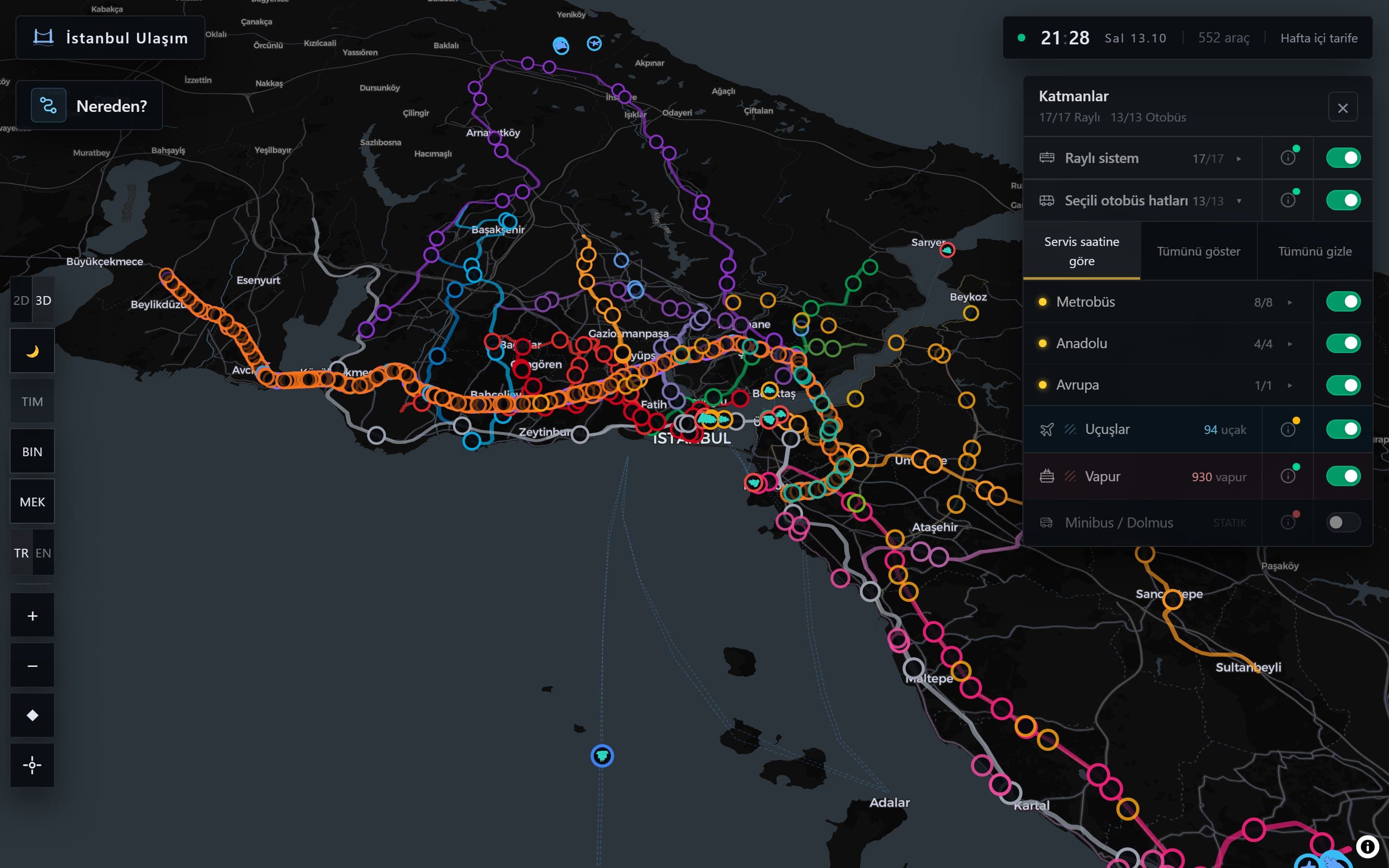
A real screenshot taken from the live product site on 13 October 2026.
About the product
İstanbulaşım brings Istanbul's transport network onto a single map. Metro and tram lines, ferry routes, the metrobus corridor and air traffic all appear in the same interface.
The application runs on real GTFS data and aircraft tracking data. Vehicle positions appear on the map live, and you can see which lines are active for the current service hours.
The product is in active development. Finished layers and features ship as they are completed, and planned work is listed separately in the roadmap below.
Verified figures
- Coverage
- Istanbul
- Transport modes
- 6 layers
- Data sources
- GTFS, aircraft tracking
- Map
- 2D and 3D
Product status: Live, in active development
What it does
- Switch between a 2D map and a 3D view
- Layers for rail, bus, metrobus, ferry, aircraft and minibus
- Real GTFS data with live vehicle positions
- Views that follow weekday and weekend service hours
- Layer controls at line and stop level
Who it is for
- People using public transport in Istanbul
- Teams working with transport and map data
- Urban planning and research teams
Infrastructure built for this product
- A data pipeline that processes GTFS feeds
- Geospatial storage and querying
- The 2D and 3D map rendering layer
- Live vehicle position streaming
Roadmap
- AI assisted journey planning
- A mobile application experience
The items below describe planned work. We do not present them as released features.